Two news items related to the national soil survey, S-map, have been posted on the Manaaki Whenua/Landcare Research website.
The first is headed
Science to underpin stewardship of New Zealand’s highly productive land
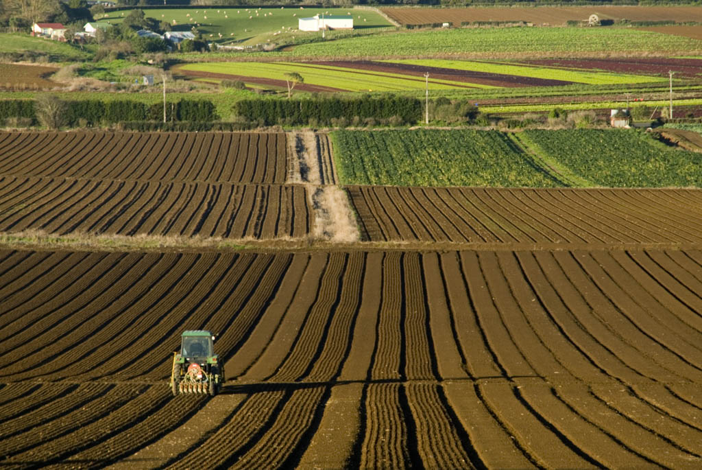
Aotearoa New Zealand is internationally renowned for its high soil diversity. Although our national soil survey is only halfway through mapping the farmed soils of New Zealand, already over 5,500 unique soil types have been identified, from the sub-tropical clay soils of Northland to the volcanic ash soils of Taranaki and Waikato, and the stony, glacially-derived soils in Canterbury and Central Otago.
Within this great variety, not all soils are equal; some are more versatile than others for supporting food production. Highly versatile soils occur in different locations, such as vegetable production in Pukekohe, dairy in Taranaki and Waikato, citrus in Gisborne, or seed production in Canterbury.
Recognising the vital role these soils provide for our export economy, as well as domestic food supply and employment, the New Zealand Government has just released a significant policy to protect the most versatile soils from ongoing urban sprawl and rural residential developments. The National Policy Statement for Highly Productive Land (NPS-HPL) came into effect from 17 October 2022.
In New Zealand the capability of different areas of land is evaluated through the Land Use Capability (LUC) classification system, which at its highest classification level assigns areas of land to one of eight LUC classes. LUC class 1 is the most versatile land, whilst LUC class 8 is the least versatile (i.e. conservation or mountain lands).
The LUC is widely used to support a number of government policies, from infrastructure and land use planning through to farm management. As such it is recognised as part of the nationally significant databases and collections.
Maps of the LUC can be viewed through Manaaki Whenua’s Our Environment website, whilst the complete dataset can be downloaded from the LRIS (Land Resource Information Systems) portal. In order to enable easier access to LUC-related documents and information, a new web portal is expected to be launched by mid-2023.
The NPS-HPL recognises highly productive land as belonging to LUC classes 1 to 3, which in its original state comprised around 14% of New Zealand. However, the Our Land 2021 national state of the environment report highlighted that cumulatively, large areas of HPL have been lost to urban sprawl and rural residential developments, with a significant impact on the past 20 years alone.
To monitor the effects of land fragmentation on HPL availability, a new environmental indicator for HPL was developed by Manaaki Whenua in collaboration with the Ministry for the Environment, Stats NZ and Waikato Regional Council. A full description of the land fragmentation indicator is available from Stats NZ. A brief summary of the science underpinning this indicator is available in our Soil Horizons newsletter.
The second item is headed
S-map has reached the halfway mark for mapping the farmable land area of Aotearoa New Zealand.
Over the past four years, and thanks to a partnership between the Ministry for Primary Industries, Manaaki Whenua, and 12 regional councils, 2 million hectares were added to the database.
A further 1.5 million hectares are expected to be completed by 2025.
Manaaki Whenua science portfolio leader Dr Sam Carrick says that within the farmable land area, the land that has the potential for multiple types of use now has 68% of its soils mapped.
Sam acknowledges the many staff who have contributed to this latest update for S-map, released at the end of August. In this past year, staff from the Hamilton, Palmerston North, Wellington and Lincoln offices have had significant involvement.
S-map is more than a soil map, it’s a soil information system, with a comprehensive database and modelling research platform (led by Dr Linda Lilburne), delivering data and information across a number of platforms and tools (led by Dr David Medyckyj-Scott).
Alongside the soil scientists and laboratory staff, who do the mapping and soil attribute characterisation, the modern soil information system includes staff across a range of disciplines, such as spatial and data science modellers, database informatics, software and website developers.
Linda says more than 5,500 different soil types have been mapped so far, with information on each soil type freely available on the popular S-map Online website.
S-map information is extensively used across a range of sectors to enable more informed decisions to manage our land within environmental limits. In the past year alone, users downloaded 54,000 soil information sheets.
In this latest update 680,000 hectares of new soil mapping was released. Newly mapped areas are located in Northland (near Moerewa), Manawatu (Horowhenua), Wellington (Wairarapa) and Canterbury (upper Rakaia) regions.
A new improved map was also published to replace five separate legacy maps, completed at different times by different people. The new map covers an area across the Hauraki Plains, Coromandel Peninsula, and the west side of the Kaimai ranges and Mamaku Plateau.
Other S-map Online updates include three new layers of soil attribute information. A new soil carbon concentration layer is available for all of New Zealand, replacing the existing soil carbon stocks layer. This layer is only suitable for viewing the spatial pattern at a regional scale; it is not accurate at the farm scale. Two layers of soil susceptibility or vulnerability are also available: nitrate leaching and by-pass flow susceptibility.
These actions to improve the stewardship of New Zealand’s highly productive land through the NPS-HPL and the land fragmentation indicator require national coverage of geospatial datasets such as the LUC, S-map, the Land Cover Database, and Protected Natural Areas.
All of these datasets represent significant public investment, often over generations, that the nation cannot afford to lose. This highlights the invaluable contribution of nationally significant databases and collections to the intergenerational availability of fundamental knowledge about our natural environment.
Source: Manaaki Whenua/Landcare Research